Flight Map
Flight map screen visually represents your flights in a map view. You can filter which flights you want to see at your flight map and you can save and share your flight ma as an image.
There are different ways to generate a flight map:
Generate a Flight Map
Dashboard Screen
The most robust way to generate a flight map is to use the Dashboard screen.
- Open Dashboard screen.
- Find Flight Map widget.
If you don't see Flight Map widget, you can add it by tapping Customize Dashboard icon at the top right corner of the screen.
- Select a timeframe and tap Generate button.
There are different time frame types you can select:
Current Month
This will generate a flight map for the current month's flights.
Last Month
This will generate a flight map for the last month's flights..
Current Year
This will generate a flight map for the current year's flights.
Last Year
This will generate a flight map for the last year's flights.
Custom Date Range
This will generate a flight map for the flights between the selected dates.
All Time
This will generate a flight map for all your flights.
Logs screen
You can also generate a flight map from the Logs screen. This is useful if you want to see the flight map for a specific filter such as crew, aircraft, type or etc.
- Open Logs screen.
- Apply a filter according to your requirement, if desired.
- Tap ... menu icon at the top right corner of the screen and select Show in Flight Map.
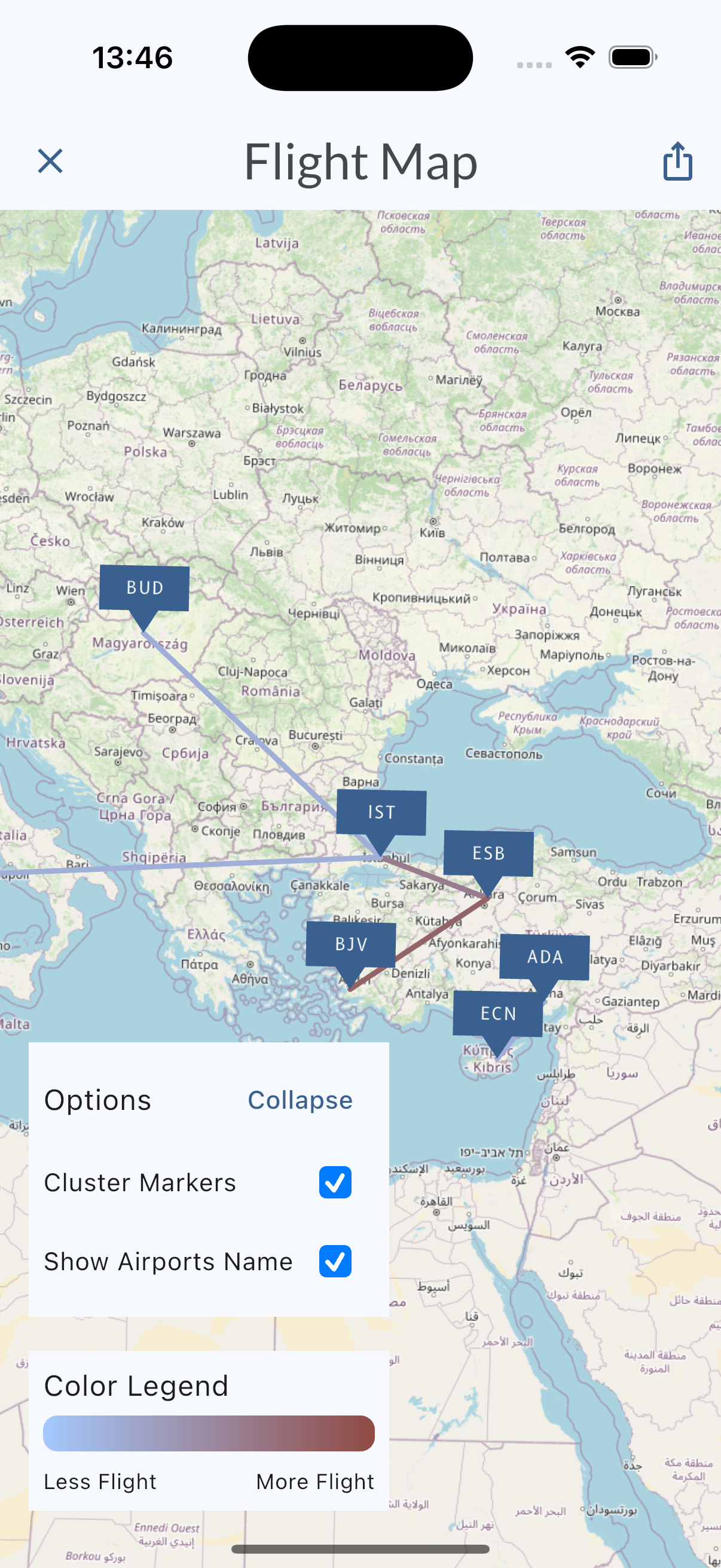
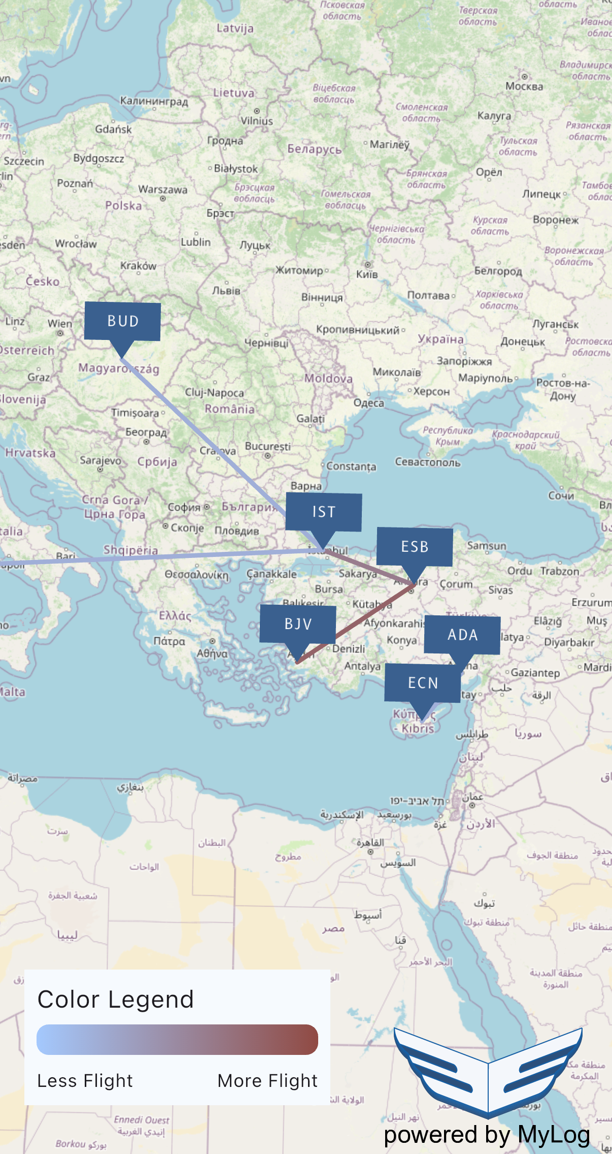
Flight Map Features
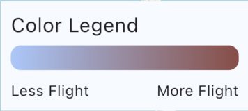
Color Coding
Flight Map uses a color code to show intensity of flights between same airports. If you flown that particular route multiple times, the color will be different than the other routes.
You can find the color code legend at the bottom of the screen.
Marker Options
For each airport MyLog will put a marker on the map for flights. You can change the marker options using Options panel at the bottom of the screen.
This panel is expandable/collapsible by tapping the Expand or Collapse button at right top right corner.
Cluster Markers
When this option is selected, markers will be clustered according to the zoom level. If there is enough space between markers, they will be shown separately. It is selected by default.
Show Airport Markers
When this option is selected, markers will be shown at the map. If you deselect markers will be hidden. Only routes will be shown. It is selected by default.
This panel will not be exists if you save the flight map image
Share Flight Map
You can save and share your flight map as an image. To do this just tap Share button at the top right corner of the screen.
To save the image use opened share sheet according to your operating system.
MyLog has need to have access to your photos to save the image.